
Download Google Earth Pro 7 for free in Thai. This program allows you to explore the world using satellite imagery, view 3D topography and buildings, measure distances, import map data, and save images in both 32-bit and 64-bit formats.
What is Google Earth Pro?
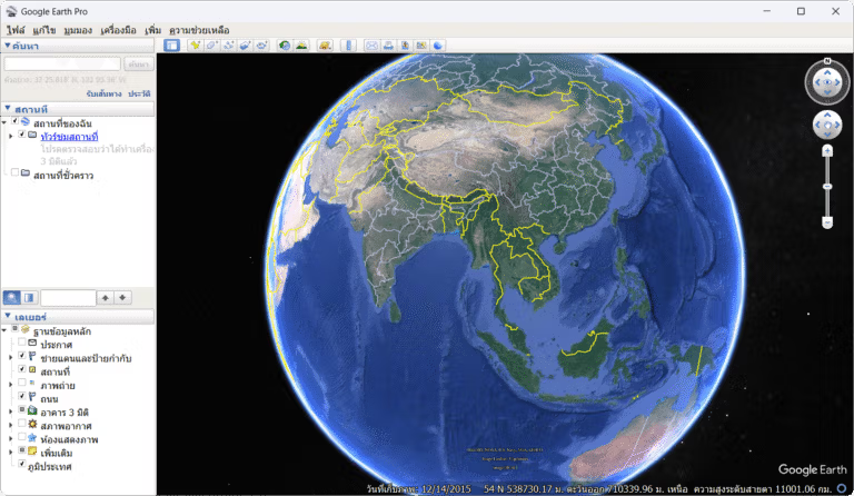
Google Earth Pro It is a computer program for exploring the world that combines satellite imagery, aerial photographs, topography, roads, places, and buildings in three dimensions onto a digital globe. We can search for city names, addresses, or coordinates, and zoom from a global view to the desired area. The program retrieves map data via the internet and caches some data locally, allowing for faster navigation of the same area. The navigation tools support rotation, tilt, and camera angle adjustment, providing a clearer view of terrain, building lines, routes, and area context than a typical two-dimensional map.
The Pro edition's highlight is its tools for more detailed tasks, such as measuring distances and areas, viewing historical photographs, creating boundary markers, routes, and polygons, and importing KML, KMZ, GeoJSON, and tabular data in supported formats. Place layers allow for viewing roads, boundaries, photographs, and geographic data together. Created work can be saved in My Places or shared as files for team collaboration, making it ideal for travel planning, geography education, preliminary land surveys, real estate, and presenting locational data.
In addition to interactive maps, Google Earth Pro can capture high-resolution imagery, print maps, create tours, and use Movie Maker to record camera movements as video. The historical imaging tool allows you to compare changes in cities, coastlines, or construction sites over time, while Street View lets you examine street-level atmospheric conditions in datad areas. For quick work with road routes, Google Maps Downloader can be used in conjunction with the software. Thus, the program serves as a comprehensive tool for surveying, referencing, and creating geographic media all in one window.
Ability
- Zoom, rotate, tilt, and adjust the camera angle to explore landscapes around the world.
- Displays satellite images, aerial photographs of roads, boundaries, and important landmarks.
- View 3D buildings and landscapes in data-supported areas.
- Search for a place by name, address, or latitude and longitude coordinates.
- Measure distance, perimeter, area, radius, and height with the Measure tool.
- Open historical photos to compare changes in the area over time.
- Create pins, routes, polygons, and folders to store items in My Places.
- Import and export KML, KMZ, GeoJSON, and supported geographic data.
- Save high-resolution images, print maps, and add titles or descriptions.
- Create tours and record camera movements as video with Movie Maker.
- Open Street View to explore street-level views in the service area.
- Save your work as a file to share markers, routes, and data layers with the team.
Improvements to Google Earth Pro 7.3.7
Here are highlights of the fixes, changes, and improvements we've made since the last major release of Google Earth Pro:

-Google Earth 10 KML compatibility improvements:
-Support for gx:CascadingStyle KML extension; KML features imported from Google Earth 10 retain styles like icons, line widths, and colors.
-Support for other extensions found in KML exported from Google Earth 10.

-Fix for app launch issue on some recent Linux releases.
-Measurement tool and property editor measurement tab use the same unit selection.
-GeoTIFF imports or super overlays can be saved as KMZs that can be opened in Google Earth 10.
-Other minor fixes and improvements.
File Information
- Operating System: Windows 11 / 10 / 8.1 / 7
- License: Freeware
- Developer: Google
- Language: Multilingual/Thai
- Size: 96 / 76 MB
- File type: *.exe
- Version: 7.3.7.1327
- Updated: 22/8/2026
- Required Reading: Download Guide